Issue
In recent years many communities have been dealing with an increased threat of flooding from sea level rise, rainfall, and riverine inundation. Flood insurance helps save communities from costly damages, but the flood insurance itself can be expensive. Luckily there are programs that can help communities reduce these costs while simultaneously implementing flood resilience strategies. Communities within a floodplain can participate in the National Flood Insurance Program’s Community Rating System to identify and implement strategies that can improve flood resilience and earn credit to lower their flood insurance premiums. However, many communities are unaware of these resources.
Process
The Digital Coast Partnership includes organizations that have expertise and resources to help communities better understand their flood risks and take action to reduce the cost of their flood insurance. The partnership team worked with three communities within the Gulf of America region: Jefferson County, Florida; City of Rockport, Texas; and Aransas County, Texas. The Nature Conservancy and NOAA’s Office for Coastal Management provided technical assistance to the three communities to identify eligible open space in the floodplain and potentially earn Community Rating System credit, with the end goal of enhancing community resilience and lowering insurance premiums.
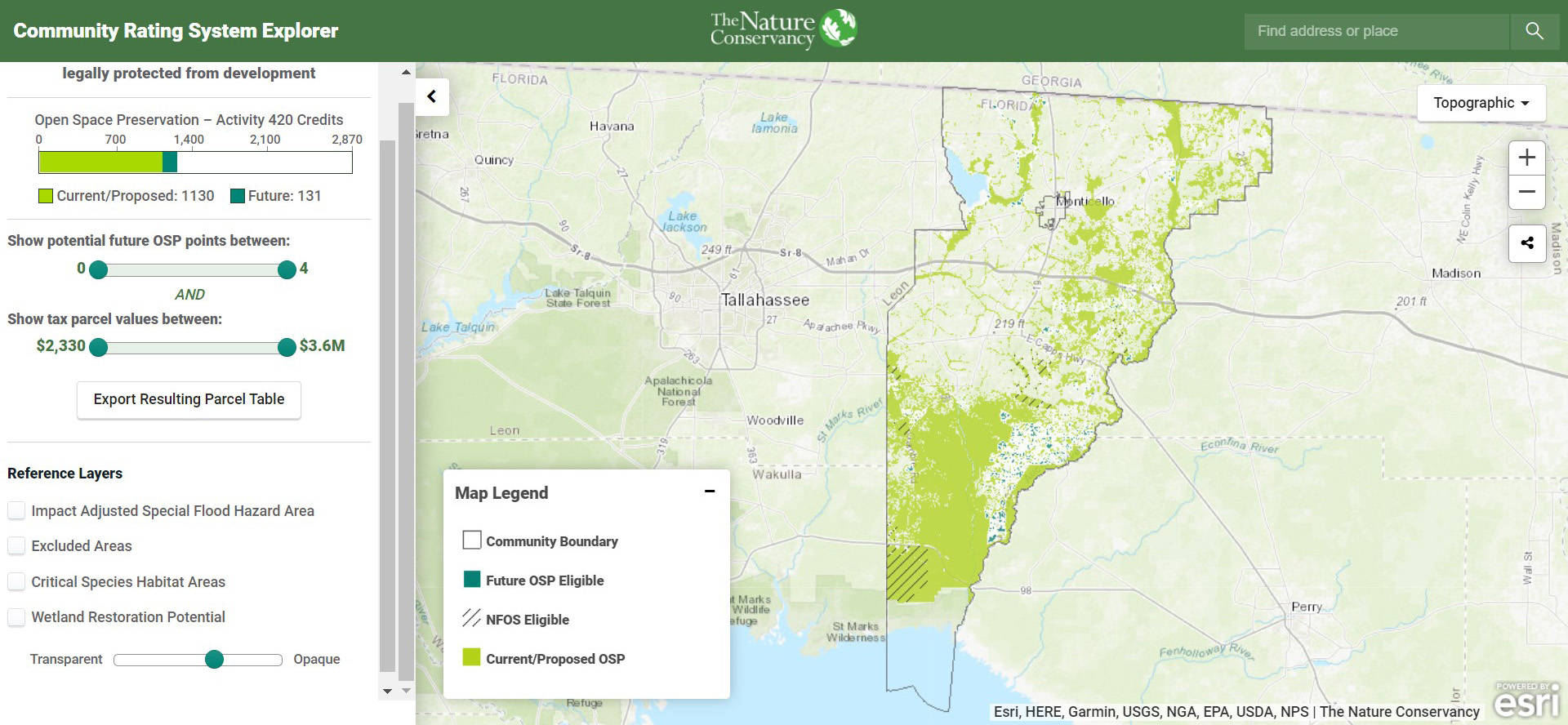
Partners from the National Estuarine Research Reserve Association, Coastal States Organization, Association of State Floodplain Managers, and American Planning Association provided input on community engagement, content expertise, process, and outreach. The project team used NOAA’s GIS workflow, a self-guided training resource that provides a step-wise approach for mapping and calculating the area of preserved open space in a community’s floodplain. The three communities were able to incorporate their results into The Nature Conservancy’s Community Rating System Explorer, a web-based tool to visualize areas where current land protections are likely earning Community Rating System points and other areas that may be eligible for future open space preservation if protected by acquisition or conservation easements.
Impact
After the communities explored their opportunities to leverage open space preservation for flood risk reduction, the team determined that Jefferson County had the highest potential gain, with over 1,000 points and the ability to advance two Community Rating System classes if these points were approved by an Insurance Services Office or Community Rating System specialist. The Nature Conservancy continues to provide technical support to the three communities as the Texas chapter of The Nature Conservancy is developing a statewide Community Rating System strategy. Jefferson County stands to lower its Community Rating System class and potentially reduce premiums by 10 percent. The Community Rating System resources used in this effort provide an excellent demonstration of how Digital Coast Partnership organizations can collaborate and co-develop resources that can be applied at the local level. This process will be used as a model for providing assistance to additional communities as needed. (2022)