Overview
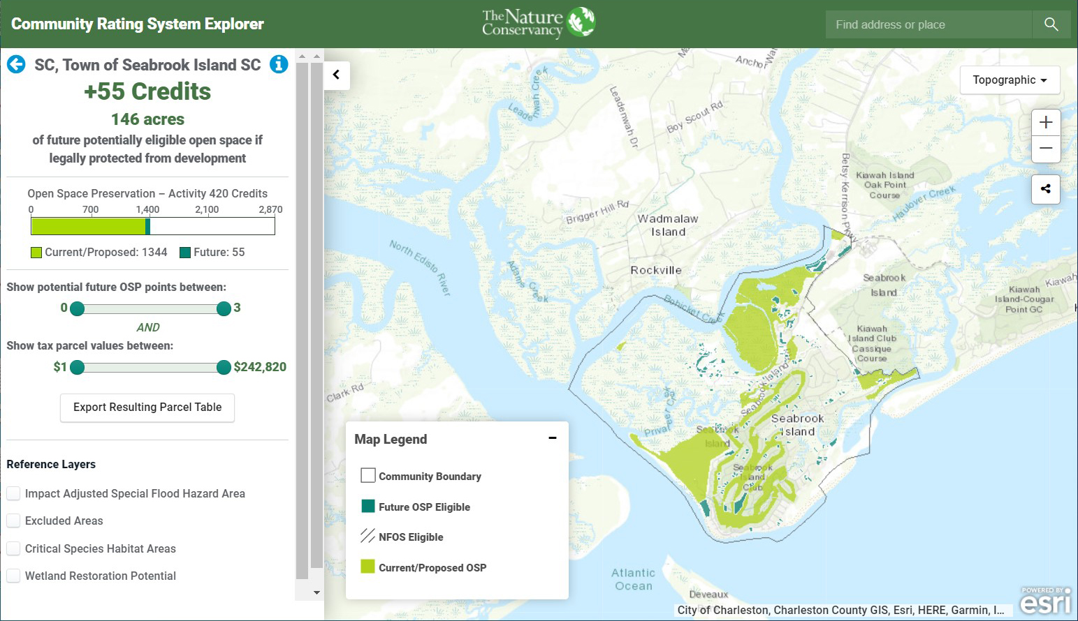
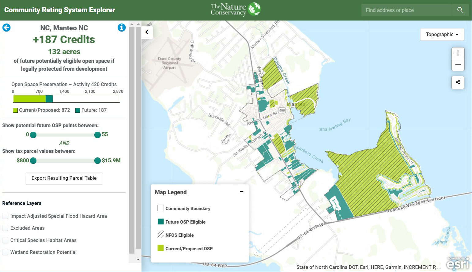
This web-based tool helps planners visualize areas where current land protections are likely earning Community Rating System (CRS) points and other areas that may be eligible for future Open Space Preservation if protected by acquisition or conservation easements. The tool identifies areas within the floodplain that, if protected, improve the community’s CRS score, reduce flood insurance costs, and make their communities more resilient to flooding. It is also helpful for communicating the importance of conserving floodplains.
Requirements
- Integrating your community's data requires completion of NOAA’s GIS Workflow – How to Map Open Space for Community Rating System Credit and contacting The Nature Conservancy to add your community to the tool
Features
- Visualize areas that currently qualify for Open Space Preservation (OSP) credit
- Identify potential future OSP-eligible areas in the floodplain
- Communicate flood risk and the importance of conserving floodplains to residents and decision-makers
Additional Information
Support
Tool Screenshots