Issue
Coastal waterways are a lifeblood for many businesses, from moving goods to landing fish caught offshore. Yet some resilience plans fail to recognize these unique benefits and the risks that face water-dependent uses that are inherently vulnerable to coastal flood hazards. The makeup of water-dependent businesses can vary greatly from community to community, so different land use plans are required to help communities become more resilient.
Process
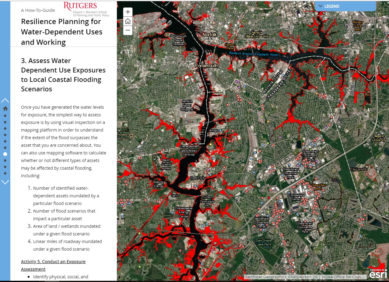
Rutgers University created a guide, Resilience Planning for Water-Dependent Uses and Working Waterfronts, which walks users through different ways to identify water-dependent businesses, define coastal hazards, and assess exposure to coastal flooding for those businesses. The guide advises communities to use NOAA’s Economics: National Ocean Watch (ENOW) Explorer tool to help them better understand their water-dependent uses and the Coastal Flood Exposure Mapper as one option to assess the exposure of these assets to coastal flooding. These can be used by communities in planning processes to improve resilience to flood hazards.
Impact
While the guide was originally created using data for Chesapeake and Cape Charles, Virginia, to show the usefulness in both urban and rural areas, the method is transferable. Other communities in coastal areas around the country are able to use this information to inform policy and land use decisions. The guide is available as both a pdf and an interactive Esri Story Map. (2018)