Overview
This web-based tool allows users to compare actual sea level with projected sea level change scenarios. Working together, these components help users estimate when and how the sea level may impact critical infrastructure and planned development activities.
Features
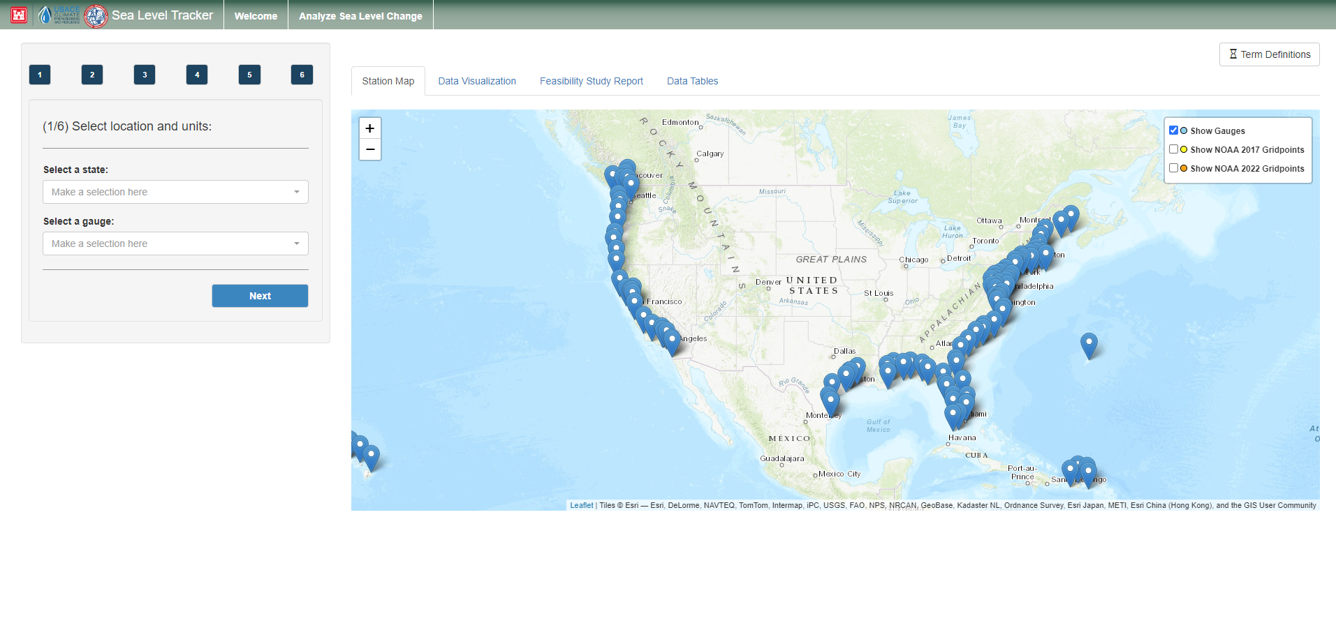
- Select the location to be analyzed and characteristics for comparison, including measurement datum, sea level curve rates, trend lines, extreme water levels, and critical elevations
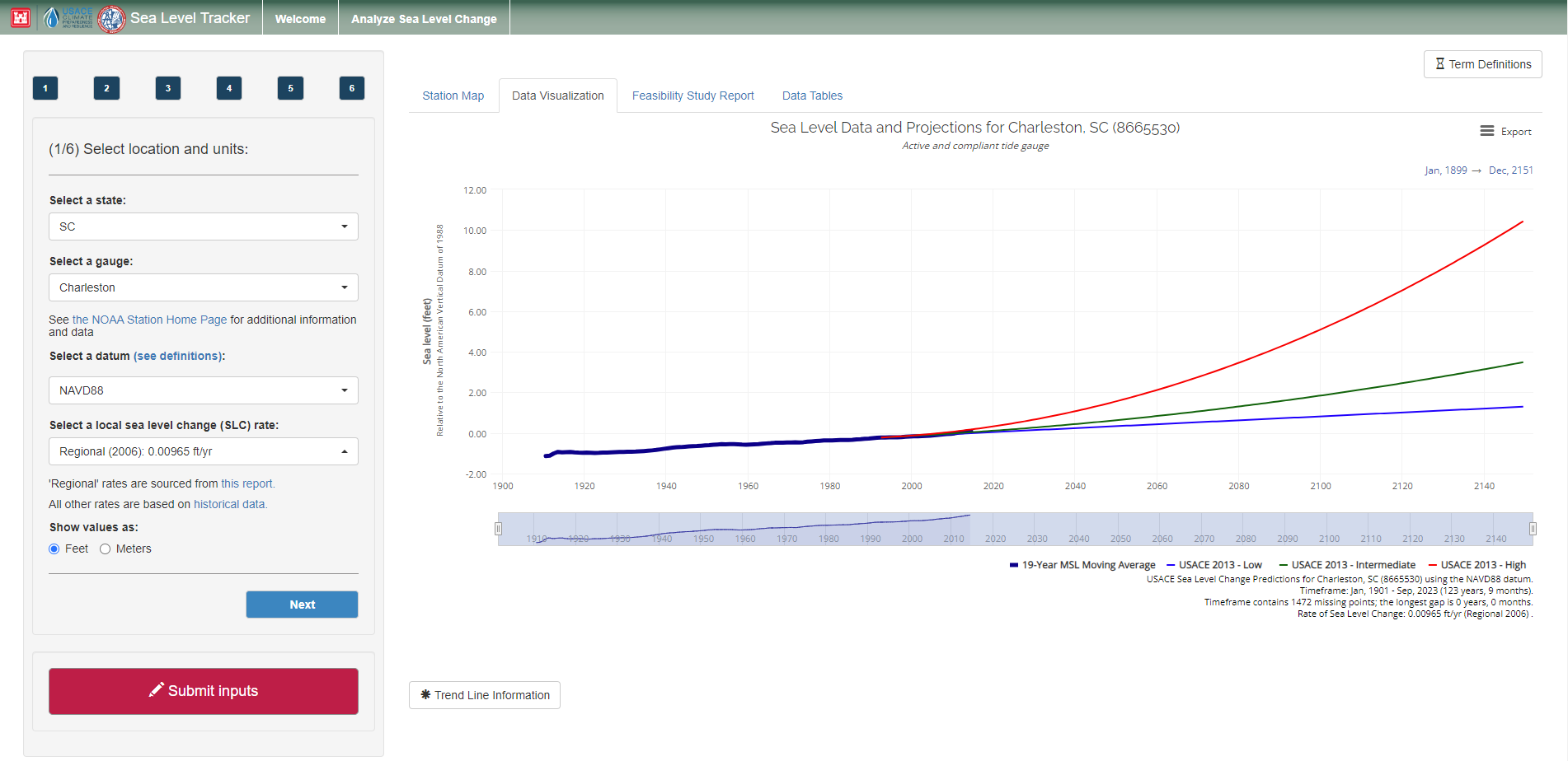
- Visualize historic hydrologic behavior while taking into account historic trends in sea level rise
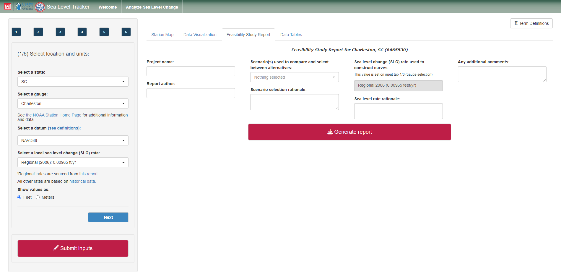
- Generate a downloadable report containing key outputs from the tool as well as the inputs used to create them
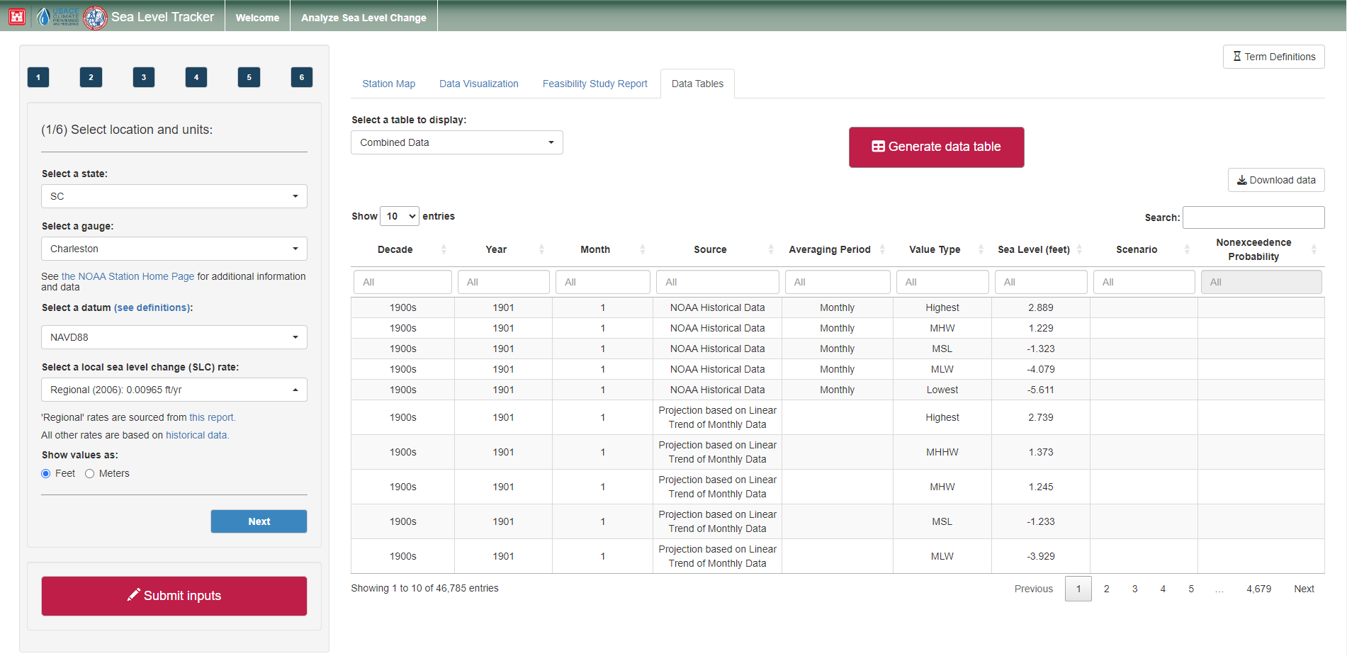
- Explore the raw data for deeper inspection
Tool Screenshots