Issue
While sea level rise is a worldwide phenomenon, mitigating its impacts is a local challenge requiring locally relevant solutions. Faced with conflicting mandates and uncertainty about next steps, land use planners and managers need decision-support tools that take their specific circumstances into account.
Process
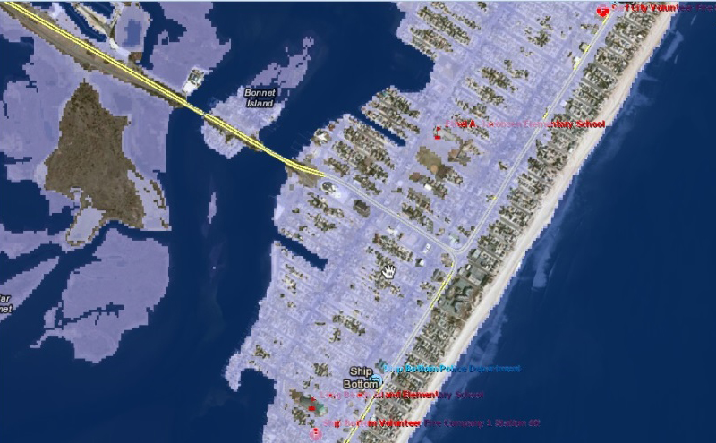
To help decision makers assess the vulnerability of key infrastructure within their communities to sea level rise and coastal inundation, the Rutgers Center for Remote Sensing and Spatial Analysis and the Jacques Cousteau National Estuarine Research Reserve developed an interactive mapping website called the NJ Flood Mapper. To create the GIS Web application, the NOAA Office for Coastal Management’s Sea Level Rise Viewer was customized to meet the needs of coastal decision makers in New Jersey. The developers identified those needs through a user-centered design process that employed an instructional systems design model. To provide full decision-support capability, the NJ Flood Mapper is being closely integrated with the Web-based Getting to Resilience community evaluation tool.
Impact
Coastal community leaders in New Jersey use the NJ Flood Mapper to compare Sandy storm surge with various levels of sea level rise and to look at future flood zones, potential marsh restoration projects, elevations and the necessity of raising or rebuilding homes to higher standards, community emergency plans, and flood mitigation and disaster and preparedness plans.