Issue
The reef-fringed Saipan Lagoon is one of the natural crown jewels of Saipan. Stretching almost the entire 12-mile length of the island’s western side, the lagoon is the focal point for recreational, commercial, and extractive uses by residents and visitors alike. The rising popularity of the lagoon, along with increased tourism and development, is resulting in conflicts between users, as well as heightened threats to the lagoon ecosystem. Managing the lagoon as a sustainable resource to be enjoyed by current and future generations requires accurate knowledge of where specific activities regularly take place.
Process
The Saipan Division of Coastal Resources Management and Allied Pacific Environmental partnered to survey local stakeholders and better understand how the lagoon is being used. The partnership’s primary approach to gathering information on lagoon uses was participatory GIS, where local stakeholders were able to draw the areas where they engage in various lagoon activities on a digital map. The partnership led a one-day workshop for over 20 participants from various user communities to collaborate and define areas their particular communities use.
The project was greatly facilitated by training and technical support from the NOAA Office for Coastal Management. The agency also provided advice on best practices for participatory GIS.
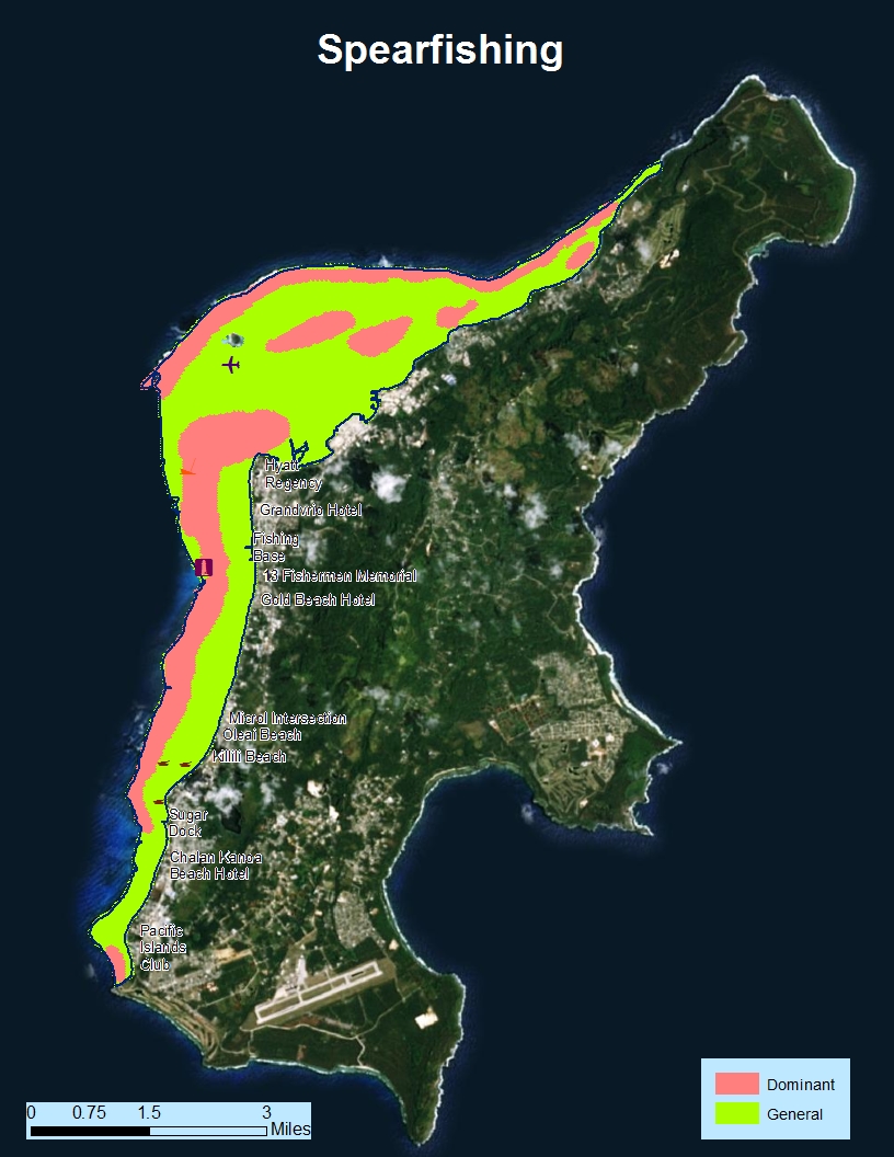
Impact
The participatory mapping workshop and supplemental surveys resulted in the development of the most detailed use maps to date. The maps and their layers have been shared publically in an interactive web mapping application. While much of the data validated previous agency perceptions on lagoon use, the maps also revealed some use patterns that were not obvious. These data will be used to inform management priorities and regulatory decisions for the Saipan Lagoon and serve as the basis for the Saipan Lagoon Use Management Plan. The goal is to protect the lagoon’s unique environmental qualities while maintaining access for residents and tourists. (2016)