Issue
Since the late 1800s, farmers in Oregon have been diking estuarine wetlands for their own agricultural benefit. Today, sea level rise is threatening to overtop and breach these dikes, as well as squeeze the remaining wetlands out of existence. Knowing the location and condition of the dikes, as well as who is responsible for maintenance, is critical for making decisions about where dikes should be breached to allow wetlands to migrate, and where dikes should be maintained to protect private and public infrastructure.
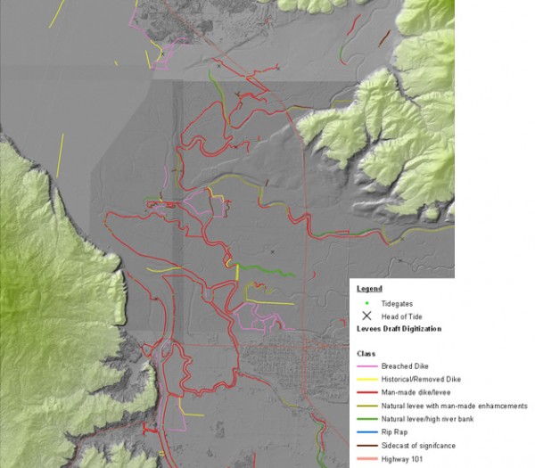
Process
The Oregon Coastal Management Program worked with the NOAA Office for Coastal Management to create a geospatial database of the dikes and levees. Using lidar, aerial photography, and a variety of other map products, the Oregon Coastal Management Program created a draft data layer of these hydromodification structures and categorized the levees. These draft maps were then verified through fieldwork and participatory mapping methods with local experts. Special districts responsible for dike maintenance were found in local government historical records. These boundaries were also included, along with a point layer for tide gates and a polygon layer representing land influenced by levees.
Impact
Many nonprofit organizations and government agencies that conduct wetland restoration work are using the dike inventory to prioritize future projects. The inventory is also being used to create more accurate predictions of what marshes and the coast would look like under different sea level rise scenarios. The two project partners are working together to deliver this and other geospatial tools to coastal planners and local governments in a way that is accessible to GIS users of various experience levels.