Issue
Hurricane Matthew in 2016 caused significant erosion along the coast of Myrtle Beach, South Carolina, damaging much of the dunes and dune vegetation. Upon initial survey, dunes appeared to be overwashed from storm surge. However, an analysis of pre-storm elevation models indicates that the majority of the city’s dunes should not have been overwashed. Further studies helped reveal the actual cause of dune erosion.
Process
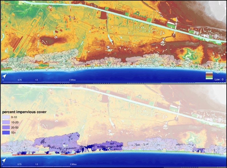
The team conducted post-storm beach surveys and used post-storm imagery to further investigate the cause of dune erosion. Using NOAA’s C-CAP land cover data from the Digital Coast, the team analyzed impervious surface coverage in relation to individual watersheds within the study area. The data were clipped to each watershed boundary to determine the percentage of impervious surface within the watershed. In addition, the study team used digital elevation models to measure dune loss along the study area.
Impact
The C-CAP land cover data indicate that the watersheds with the highest concentration of impervious surface areas drain directly toward the beach, supporting the theory that dune erosion may have been caused by surface and groundwater flow rather than storm surge. Knowing the cause of the erosion helps coastal managers make informed decisions about how best to protect their coastal areas. (2020)