Issue
Development pressure, rising sea levels, and increasing storms are eroding beaches and coastal bluffs throughout Maine. The state’s coastal management program is seeking to increase community resilience and reduce risk to people, infrastructure, and habitat from coastal flooding and erosion, while maintaining and enhancing coastal ecosystem function through successful application of nature-based coastal infrastructure.
Process
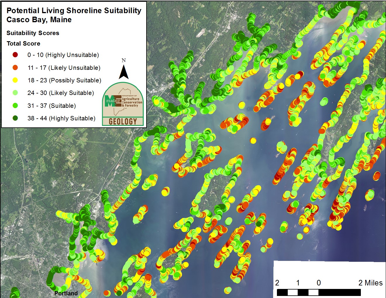
The Maine Geological Survey worked directly with several partners to develop a nature-based coastal infrastructure site-suitability model, which includes attributes such as shoreline type, bluff condition, nearshore bathymetry, fetch, aspect, and the presence of special habitats. After scoring shoreline reaches based on the suitability model, planners used oblique imagery to identify and verify sites exhibiting coastal bluff or marsh-edge erosion.
Impact
Initial development occurred in Casco Bay, Maine, and is being expanded to other geographic regions in the state, including beach and dune environments. The geospatial model and resulting map helped identify several sites within Casco Bay where various forms of nature-based infrastructure implementation projects would likely succeed and provide necessary protection and ecosystem service benefits. NOAA’s Coastal Management Fellow in New Hampshire also used Maine’s work as a basis for adapting the suitability tool for use along the New Hampshire coastline. This information, developed with a NOAA regional coastal resilience grant and a project of special merit, helps position Maine to participate in coastal resilience projects with other New England states and a variety of additional partners. (2018, updated 2024)
Additional Resources
Maine Geological Survey Living Shorelines Decision Support Tool