Issue
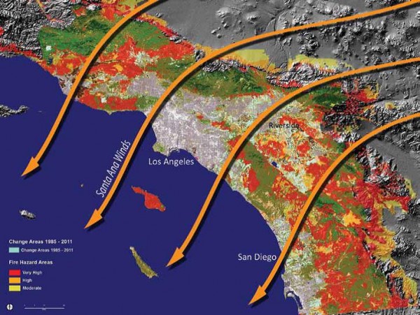
Southern California’s weather, topography, vegetation, and wind patterns put the state at great risk for wildfires. Over the past few decades, enduring droughts and increased development have exacerbated conditions.
Process
The Global Ecosystem Center used NOAA’s land cover data sets (from 1996, 2001, and 2005) to analyze areas at risk, their proximity to urban developments, and changes over time. (These nationally standardized data can be compared against one another to document changes over multiple years.) The group also used additional archived Landsat imagery from 1984 to 2011, which provided an overall analysis that spanned 26 years of data.
Impact
The data showed the region between Los Angeles and San Diego experiencing the highest rates of urban growth, with many of the new developments in areas of significant fire risk. This information is being used to develop better strategies for land use management, natural resource management, and vulnerability.