Issue
While existing estuarine classification systems based on remote sensing imagery are excellent tools, there are shortcomings. Few are able to integrate freshwater to estuarine gradients or address regional factors that contribute to estuarine ecosystem distributions and processes. Most classifications fail to capture larger landscape-scale features that account for the inherent diversity of estuarine ecosystems.
Process
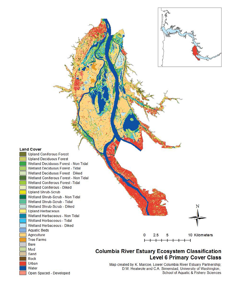
By partnering with Sanborn and NOAA, the Lower Columbia Estuary Partnership was able to capitalize on an innovative approach to land cover mapping involving image segmentation and object-based classification. By using 2009 one-meter resolution imagery from the U.S. Department of Agriculture National Agriculture Inventory Program, 30-meter resolution landsat imagery, and lidar elevation data from U.S. Army Corps of Engineers, the team was able to create a land cover classification map tailored to the Lower Columbia River and Estuary. They were also able to leverage the NOAA’s C-CAP land cover scheme in developing this classification. The chosen classification scheme was based on existing, standard classifications, with additional focus placed on identifying estuarine and tidal freshwater habitats.
Impact
The final land cover map comprises a new, hierarchical ecosystem classification system specific to the Lower Columbia Estuary. The estuary partnership completed this system in collaboration with the University of Washington and U.S. Geological Survey. It integrates estuarine and tidal freshwater reaches of this large floodplain river, which is strongly influenced by both riverine and estuarine hydrology. The Columbia River Estuary Ecosystem Classification is based on six hierarchical levels, progressing from the coarsest, regional scale of the Ecosystem Province class to the finest, localized scale Primary Cover class. The recently completed 2010 Lower Columbia River Estuary Land Cover Classification, developed in partnership with NOAA’s C-CAP land cover effort, played an integral part in completing the Primary Cover class.